
Atascocita ZIP Code Coverage
Atascocita's primary postal search ZIP codes are 77346 and 77396. Both use the Humble post-office label and both can reach addresses near the Census-designated place. Postal coverage is not a city-limit test. The nearby Humble codes below are useful only as address-specific leads, because the research did not establish that they cover the Atascocita CDP as a whole.
| ZIP | Areas Covered | Post Office | Notes |
|---|---|---|---|
| 77346 | Core Atascocita postal addresses, the branch area, and many Pinehurst and ACIA communities | Humble | Postal coverage only; confirm an individual address with USPS |
| 77396 | Atascocita and nearby northeastern Harris County community and road addresses | Humble | Parts can fall outside the Census CDP or overlap adjoining communities |
| 77338 | Adjacent Humble-area postal route | Humble | Do not count it as CDP-wide Atascocita coverage without an address result |
| 77347 | Humble route, PO, or special-delivery geography | Humble | An adjacent or related code, not verified as CDP-wide coverage |
| 77325, 77339, 77345 | Kingwood and Humble-area adjacent routes | Humble | Listed in USPS materials, but not automatically Atascocita |
Use USPS ZIP Code Lookup to check an exact street address. USPS describes ZIPs as delivery geography and does not treat a result as confirmation of a person or company.
Atascocita ZIP Code Geography
Atascocita is a Census-designated place, not an incorporated city. The 2020 Census count was 88,174 across 23.88 square miles, but that statistical boundary is not a USPS boundary or a municipal limit. The same address can have an Atascocita community identity, a Humble postal city line, Harris County jurisdiction, a MUD service area, and a subdivision name in a deed or association record.
Local names make the distinction practical. The 2026 ACIA map uses labels such as Pinehurst, Pines, Ivy Point, Golf Villas, Estates of Pinehurst, Club Point, and Shores, with MUD 132, 151, and 153 overlaid. HCAD map sheets also use labels such as Atascocita Commons R/P, Atascocita Town Center, and Kingwood Glen. These can be good legal-description or map-search terms, but they are not substitutes for an exact address or parcel account.
No verified ZIP split or realignment year specific to Atascocita was located. That absence matters at the edge of 77346 and 77396: do not extend a primary ZIP to a neighboring community merely because the postal city line says Humble. USPS address verification, the HCAD situs field, and the mapped parcel should be compared one address at a time.
Postal label and CDP boundary. A standardized Humble city line from USPS is expected for many local addresses. It does not mean the address is outside the Atascocita community, and a 77346 or 77396 result does not by itself place an address inside the Census CDP.
Atascocita ZIP Code HCAD Filters
The HCAD advanced Real Property Search accepts a five-digit ZIP and can combine it with owner, street, number range, legal description, school district, map key, building style, and sorting controls. It returns appraisal accounts, not a complete list of residents. Begin broadly enough to identify the right area, then narrow with the street or subdivision before interpreting a result set.
| HCAD field | ZIP-capable use |
|---|---|
| ZIP Code | Optional five-digit filter for a postal area |
| Property Street Name | Optional street filter; the similar-street-name checkbox expands matching |
| Beginning and Ending Street Number | Optional numeric range for a smaller segment |
| Owner Name | Last name with first initial or name; partial and case-insensitive searching is supported |
| Legal Description | Subdivision, section, lot, block, or other legal-description text |
| Key Map and Map Facet | Map-reference filters such as 483C or 5271A |
| School District, State Category, Building Style | Additional property filters supplied by the portal |
HCAD limits a result set to 3,001 records. The account's mailing address can differ from its situs address, and a public card may show an owner of record who is not a current occupant. Corrected data usually appears after a nightly refresh, with at least three days suggested for changes.
A returned parcel card can include a 13-digit account number, owner name, situs and mailing addresses, legal description, valuation fields, exemptions, taxing jurisdictions, building details, map key or facet, and a map or sketch. Save the account number exactly. The sketch and parcel map are useful locators, but the research warns that the map is approximate and not a survey.
Use the source controls at HCAD advanced search before narrowing an Atascocita ZIP code result.
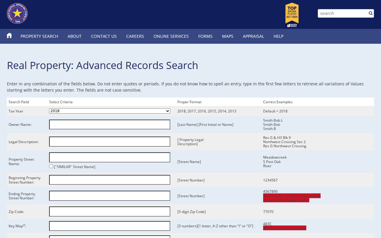
The form shows why ZIP is best paired with street, legal-description, or map fields when a primary Atascocita postal area returns too many accounts.
Atascocita ZIP Code Search Steps
Use a ZIP as a narrowing tool, then confirm each candidate with a property address and the parcel's legal description. Postal labels change more easily than recorded parcel identifiers. The following sequence keeps a search focused on the specific Atascocita address rather than an entire Humble-area delivery route.
- Enter the exact street address in the USPS address-to-ZIP lookup and record the standardized ZIP and city line.
- Use that five-digit ZIP in HCAD, then add a street name, number range, subdivision text, or map reference to reduce broad results.
- Open the resulting account and compare the situs address, mailing address, legal description, and account number. Treat those fields as different facts.
- Use the HCAD or Harris County GIS map to check the parcel's position, while remembering that map boundaries are approximate and not a survey.
- For an individual registration match, enter the requested name, Harris County, date of birth, and ZIP in My Voter Portal rather than attempting a ZIP-wide browse.
Once the ZIP points to a particular street, the Atascocita street directory has the address-focused record trail. A ZIP filter does not replace a parcel-level review.
Atascocita ZIP Code Voter Matches
Texas My Voter Portal accepts ZIP as part of an individual match. Its name path also uses first and last name, Harris County, and requested identifying information. A match can return registration status, polling place, precinct, and election information. It is not a public screen for listing every person in 77346 or 77396, and it does not disclose ballot choices.
A separate Texas voter-file request can use state or county scope and filters such as Texas mailing address, effective-registration dates, age range, and selected elections. That request is not a normal ZIP browse route, is fee-based, and carries statutory restrictions. A no-match in the individual portal can reflect spelling, county, birth date, ZIP, status, a recent move, or a refresh mismatch.
Note: Voter data can include protected or suppressed records, so a ZIP or registration count should not be treated as a household count.
Atascocita ZIP Code Result Limits
ZIP-wide counts describe different things in different systems. HCAD counts appraisal accounts, not postal households. A broad HCAD query can include commercial parcels, MUD parcels, common areas, vacant land, and multiple units. A community-association certificate can identify a legal association, not the number of homes. Census figures describe a statistical population, while voter data counts registrants and can include suppressed records.
For an Atascocita ZIP code directory search, the practical result is a list of records to verify, not a population total. A large ZIP response may include edge-area parcels whose postal route overlaps the community name. Keep the ZIP beside the physical situs address, account number, and legal description so later searches do not mix a delivery label with a parcel identity.
The Texas community-association search can filter by Harris County, city, and ZIP. Research found Atascocita West CIA, Atasca Woods, Oaks of Atascocita, and Atascocita Trace in rows using 77346 or 77396. Those results help identify the association layer, but they do not establish a boundary or a public household roster. No official ZIP-by-ZIP registration statistics or verified Atascocita ZIP realignment year was located.
Sort HCAD results and narrow by street, subdivision, map facet, or property category before treating the remaining accounts as a manageable research set.
Atascocita ZIP Code Boundaries
Postal, parcel, and community boundaries should be read separately. HCAD and Harris County GIS use a physical situs address and map layers. A tax mailing address can point to another city or ZIP. USPS supplies a delivery route. The CDP is Census geography. School district, precinct, MUD, and association boundaries can cross or sit within the same postal area. There is no verified public map in the research that overlays all of those layers for every edge address.
- ZIP and ZIP+4
- A five-digit ZIP identifies a broad delivery area. ZIP+4 adds a narrower delivery segment and is not a community boundary.
- PO-box ZIP
- A ZIP assigned to post-office box delivery rather than a general street-delivery area.
- Unique ZIP
- A ZIP assigned to a single organization or delivery purpose, rather than a normal neighborhood route.
- Carrier route
- A postal delivery sequence that can cross community names and is not a legal-jurisdiction line.
Atascocita ZIP Code Address Keys
A parcel account, legal description, map key, and lot or block are stronger identifiers than a postal city label. HCAD's parcel card can show the account number, owner of record, situs and mailing addresses, legal description, values, jurisdictions, property characteristics, map links, and an ownership-history link where available. The map is approximate and not a survey, so recorded deed material remains the follow-up for title questions.
Harris County's map-based address lookup and the HCAD Parcel Viewer help place a selected parcel among nearby roads and subdivisions. Their layers can bridge an address to an account, but GIS and property data can lag changes. Preserve the exact legal description when moving to a recorded-instrument search.
Check an address first with USPS ZIP Code Lookup.
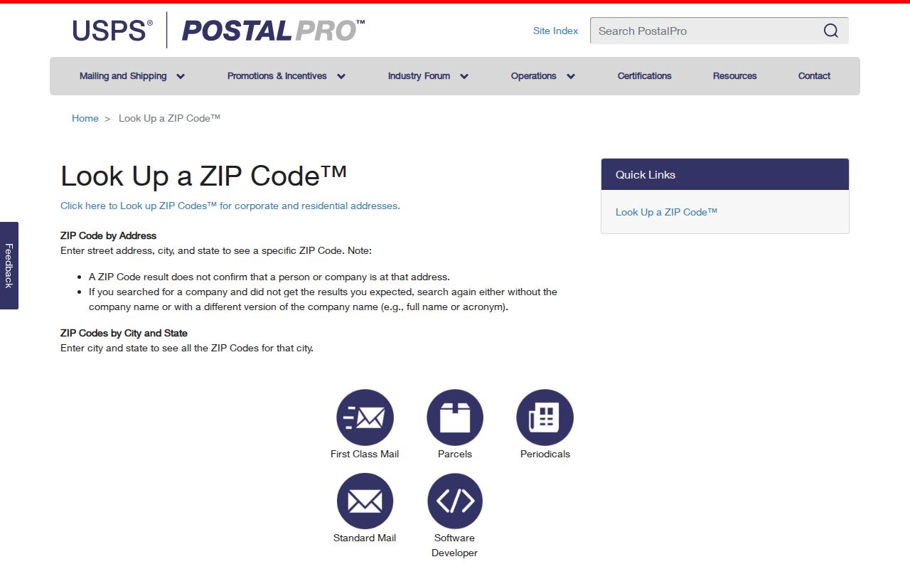
The USPS screen offers address-to-ZIP and city-and-state routes, but the exact address mode is the safer choice for Atascocita edge areas.